“The role of a geologist is much like the role of a crime scene investigator,” says Joel Cubley, geology instructor at Yukon College in Whitehorse. Geologists try to figure out what happened long ago in Earth’s history from small, fragmentary clues, he explains. But what took place long ago was certainly not small.
Cubley’s specialty is tectonics, and that’s just about as big as it gets. It’s the study of the movements of the great plates that carry the continents slowly over the face of Earth, pushing up mountains and excavating oceans as they go.
 |
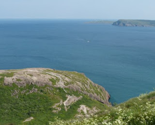
| Out there, beyond the east coast of Newfoundland, the Atlantic Ocean is slowly getting wider. Claire Eamer photo |
Tectonics is a relatively new field. About a century ago, German scientist Alfred Wegener suggested that the continents move, but most geologists thought he was talking nonsense. It wasn’t until well into the 1950s that American scientists using sound waves to map the ocean floors found proof of Wegener’s theory. Marie Tharp, one of the few women working in geology at the time, spotted what looked like a rift valley on the floor of the North Atlantic Ocean. It turned out to be exactly that — a place where two parts of Earth’s crust are pulling apart, widening the ocean and pushing Europe and North America away from each other about as quickly as your fingernail grows.
Even that slow movement, over time, can create huge changes. On the west side of North America, tectonic movement has thrown up range after range of mountains between the eastern slopes of the Rockies and the Pacific Coast. Cubley is particularly interested in gap between a couple of those ranges, a place where two sections of crust have moved in a way that stretches the surface rock. It’s a 200-kilometre-wide zone of jumbled ridges and valleys called the Grand Forks Complex, lying roughly between Castlegar and Revelstoke in southern British Columbia and extending down into Washington State.
 |
| The snow-capped St. Elias Mountains, the highest in Canada, were created by slow tectonic movement. Claire Eamer photo |
A feature of the Grand Forks Complex is occasional outcrops of metamorphic rocks, hundreds of millions of years older than the surrounding rock. How did they get there? That, in simple terms, was the subject of Cubley’s doctoral research.
“Metamorphic rocks are just rocks that have been cooked,” he says. Where Earth’s crust is pulling apart strongly enough to create a crack or fault, super-hot “cooked” rock can well up from far below the surface. Cubley suspected that the metamorphic rock in the Grand Forks Complex was evidence of a fault. But where?
In places like the Great Rift Valley in Africa, the fault is obvious – and huge. But the fault associated with the metamorphic rocks of the Grand Forks Complex would be much smaller and harder to spot. Cubley tackled the problem in the traditional geologist’s way, by sampling and mapping rocks on foot.
He spent several summers bushwhacking across the rough, wild landscape of south-central British Columbia, camping, hauling gear, and swatting bugs. When he finally found the fault, it was a bit of a let-down.
“It was a shallow ravine full of scrubby trees,” says Cubley. “That was kind of soul-destroying!”
But not for long. Cubley’s soul bounced back, and he’s well on his way to understanding how that modest ravine is linked to the unusual rocks of the Grand Forks Complex.
What he knows at this point is that the metamorphic rocks were formed at a depth of about 20 kilometres and a temperature of about 750 degrees C. Roughly 50 million years ago (almost yesterday in geologic terms), they welled all the way up to the surface and then cooled very quickly.
“I still can’t explain how they got to the surface that quickly,” Cubley says. But, with the help of a great deal of modern technology (and some more bushwhacking), he’s working on it.
No comments:
Post a Comment