Showing posts with label archaeology. Show all posts

25 Jul 2020

Chauvet Cave Virtual Tour

by Paula Johanson
Are you interested in studying the lives of people from the Stone Age? Whether you're a scientist or just interested in learning something about archaeology, there are LOTS of ways to study the traces left by these people and their lives.
The best one I've found this week is a virtual tour of a cave in France called Chauvet. It's near the famous Lascaux cave, and like Lascaux it has astonishing images painted on the walls. Chauvet cave was closed off by a landslide thousands of years ago, so the images are well-preserved and undisturbed.
Take some time to go to this link at https://archeologie.culture.fr/chauvet/en to see a very detailed website. There's a menu tab on the left, that leads to a list of many short articles. There are details on the discovery of the cave, this region in France, replicas of the art, as well as a bibliography and glossary.

But if you can take yourself away from all these resources, the primary reason to go to this website is to take a virtual tour of Chauvet cave! On the walls of this cave are drawings in black or red, showing animals and scenes and markings drawn by people many thousands of years ago. Some marks are smudgy, some are precise, and all are interesting.


There is also a terrific website about archaeology, by the Bradshaw Foundation. Their section on Chauvet cave has many images and descriptions of the cave art.
Because Lascaux cave has been damaged by light, dust, and the breath of visitors, scientists have declared that Chauvet cave will be visited only by a very few experts. Each year only a handful of people enter the cave, to preserve the site. This virtual tour is available to everyone.


If you want to learn more about Chauvet cave and archaelogy, there are books available at your public library. That's where I found all three of these books on cave art that were recommended by the Bradshaw Foundation. Though these books are intended for adults, there's no reason a child can't look through the beautifully clear photographs and read a little here and there, especially with an adult. My own book The Paleolithic Revolution is a good choice for the first book to read on the lives of these long-ago humans, and it is a book well-suited to young people or to adults who are new to this topic.


Another way to tour Chauvet cave is to watch a Werner von Herzog film called Cave of Forgotten Dreams. Here's a link to the Wikipedia page on this amazing movie, directed by an award-winning film maker. The director was given permission to film inside the cave, using 3D techniques, which show something that photographs in books cannot show.
The paintings are not made on flat walls, but on surfaces that change how the drawings look. When an animal was drawn, the bumps and hollows on the wall filled out the shape or can change how it is seen. A light held in one hand can be moved to make the shadows change.
When the film was first released in 2010 I watched it in a theatre. The 3D effect of some scenes in this film makes me a little dizzy after a while, because I have an inner-ear problem. My husband had no trouble with dizziness, but he didn't know what the cave paintings looked like, so I found him a book and THEN he knew what he was seeing in the film. We have since then watched the film again, using our computers; bigger screens instead of tablets are worth it for this film!
Cave of Forgotten Dreams is available on Netflix. If you search in Google you can find excerpts from the film on YouTube and the entire film is available on DVD. Ask at your library or buy a copy.

My advice? First, look through this virtual tour of the cave. Then explore the Bradshaw website images or get a book with the cave paintings, like Chauvet Cave: The Art of Forgotten Times by Jean Clottes -- or something similar. I found books at the library! Then watch Cave of Forgotten Dreams on a big screen TV. Amazing.

28 Feb 2020

Everything Old is New Again

By Claire Eamer

An atlatl is a throwing stick. It’s a tool used to extend the reach and flexibility of a hunter’s arm so that he or she can throw a light spear farther, harder, and faster. And very accurately. The word atlatl comes from the Nahuatl language of the Aztecs, who used atlatls in hunting and war.

A model at the Natural History Museum in Vienna, Austria, shows an ancient
hunter using a simple atlatl and dart. Photo by Wolfgang Sauber.
At its simplest, an atlatl is a stick with a hook at one end. The hook fits into a dimple in the base of the spear – usually called a dart. The hunter holds the atlatl and dart in one hand, sweeps both forward in a throwing motion, and lets the dart fly.

Atlatl throwing. Illustration by Drew Shannon for
Out of the Ice: How Climate Change is Revealing the Past (Kids Can Press, 2018)
Sounds simple, but it’s so effective that people on all continents have used atlatls for thousands of years, and many still use them. Although it has been overshadowed in most cultures by the bow and arrow and by firearms, an atlatl is still a cheap, easy-to-make, and easy-to-use hunting weapon. All you really need to make one is a small knife and a straight-ish stick.

These two atlatls, currently in the Houston Museum of Natural Science, are
between 12,000 and 17,000 years old. They were found in caves or rock shelters in France.
The animal carved on the lower atlatl has been identified as a hyena. Claire Eamer photo.
Of course, not all atlatls are simple sticks. Humans like to embellish their tools. A couple of atlatls found in dry caves in France have carved images of animals that have been extinct in Europe for thousands of years. An Aztec atlatl in the British Museum is elaborately carved with images of warriors or gods and covered with gold.

I first heard about atlatls in the late 1990s, when I lived in the Yukon. A friend, Environment Canada caribou biologist Don Russell, was asked to confirm discovery of what appeared to be huge quantities of caribou droppings melting out of a high alpine ice patch near Whitehorse. (For the full story, see my book Out of the Ice: How Climate Change is Revealing the Past.)

Dimples in the ends of atlatl darts.
Illustration by Drew Shannon for
Out of the Ice: How Climate Change is
Revealing the Past
(Kids Can Press, 2018)
Don spotted something odd lying on the rocks beside the ice patch. It was a stick. Far above treeline, with no other wood around, he found a stick – with what looked like string wrapped around it and a tattered bit of feather.

“Cool,” said the archaeologists (more or less), when presented with the stick. “Part of an arrow, maybe even a century old. Very rare.” But testing showed it was even cooler. The stick was 4300 years old, and it wasn’t an arrow. The tell-tale dimple at one end showed that it was the remains of an atlatl dart. Long ago, around the time that ancient Britons were building Stonehenge, a hunter in the Yukon mountains flung a dart at a caribou – and missed. The dart disappeared into the snow and ice where the cold preserved it.

That was the first direct evidence of atlatl use in the Yukon. Wood normally disintegrates in a few years unless it’s preserved in some way – usually by extreme dryness or extreme cold. Cold is what saved the Yukon atlatl dart, and it has preserved other things too. Lots more wooden artifacts, including the rest of the dart Don found, have been discovered in the ice patches, as well as bone, antler, leather, and other materials that normally don’t survive for thousands of years. 
Kids choose their weapons at the atlatl range at the
Yukon Beringia Interpretive Centre in Whitehorse.
Yukon Government photo.
Today, most school kids in the Yukon know about atlatls and might even have tried their hand at them. Elsewhere, too, people are experimenting with atlatls. There are even formal atlatl competitions and modern atlatl hunters. It is, indeed, a case of “Everything old is new again.”

Ready to throw at the Yukon Beringia Interpretive Centre's atlatl target range.
Yukon Government photo
If you want to know more about the Yukon Ice Patches and see some of the finds, check out The Frozen Past, an illustrated booklet produced by the Yukon Government and the First Nations involved in the ice patch research.

If you'd like to see video of people throwing atlatls, here is the 2012 Atlatl Competition at Anasazi State Park Museum in the United States.


And, of course, you can always consult my own book -- Out of the Ice: How Climate Change is Revealing the Past (Kids Can Press, 2018) -- for the story of the Yukon discoveries and frozen discoveries elsewhere in the world.

13 Dec 2019

Food on the Move

By Claire Eamer

A vital component of a turkey dinner.
Image by skeeze from Pixabay
I've been thinking a lot about food lately. One reason is that I have been auditing a university class on food and drink in the archaeological record. Somehow, ancient peoples seem much more real when you start to figure out what they snacked on during a workday and what they ate and drank at a feast.

(Auditing classes, I've discovered, is a blast! All the fun of learning with none of the stress of exams.)

The other reason for thinking of food, of course, is that we're approaching the season of winter feasting. Turkey dinner. Mashed potatoes. Corn on the cob. Roasted squash. Cranberry sauce. Maybe a little hot sauce on the side for those who like dash of fire with their food.
But if you'd mentioned any of those foods to someone from Europe, Africa, or any part of Asia 600 years ago, they would have been baffled. All those foods came from the Americas, and no one outside the Americas had eaten them until the European invasion of the Americas began just over 500 years ago.

(Okay -- Europe has a kind of wild cranberry, but it's not the sort you'll find in the cranberry sauce served with your Christmas turkey.)

I learned just how many foods originated in the Americas a few years ago when I was researching The World in Your Lunch Box: The Wacky History and Weird Science of Everyday Foods. I was amazed -- not just at the variety of foods, but at how skilled the farmers of the Americas were and how quickly their foods spread to the rest of the world.

Teosinte is on the left, and modern corn is on the
right. Between them is a hybrid of teosinte and corn.
Image by John Doebley.
Consider, for example, corn. At least 8000 years ago, the people who lived in what is now Mexico and Central America began a long process of crop breeding that turned a common grass called teosinte into maize -- the plant served up as everything from tortillas to corn on the cob. Today, maize is still an extremely important food in Central and South America, but it's also the most important food crop in much of sub-Saharan Africa.

Or look at potatoes. They come from the Andes in South America, and you'll still find the biggest variety of potatoes there. But 500 years ago, the Spanish took a few kinds of potatoes back to Europe, and they spread. They spread so far and so fast that China is now the world's biggest producer and consumer of potatoes.

And that delicious-smelling turkey? The Ancient Puebloans who lived in the famous cliff dwellings of Mesa Verde 800 years ago kept turkeys penned in the alcoves behind their houses. In other parts of North America, such as the forests of what is now the eastern United States, turkeys were so plentiful that people didn't bother to keep them penned up. Why feed a bird when it can feed itself and still be available to hunt when you need it?

Those are just a few of the foods that came from the Americas. They, along with chili peppers, tomatoes, squash, chocolate, and a cornucopia of other delights, changed the nature and flavour of food around the world.

Now I'm hungry!

15 Nov 2019

Fishy Sauce and a Fishy Date

By Claire Eamer

The Garum Shop in the ancient Roman city of Pompeii was a small business that manufactured and sold a fish sauce called garum that Romans adored. The shop went out of business suddenly and permanently in 79 CE when the nearby volcano, Mount Vesuvius, erupted and buried it, the city, and several other communities under metres of volcanic rock and hot ash.

This is the Triclinium or dining room of a wealthy family
in Pompeii. The diners would have reclined on beds while
eating dishes liberally laced with garum. Claire Eamer photo.
In 1960, archaeologists uncovered the Garum Shop for the first time in 1880 years. Buried with it were six large ceramic containers called dolia and several of the large pottery vessels called amphorae used for everything from wine to -- in this case -- fish processing. The dolia contained the remains of garum in several stages of production, and some of the amphorae contained the well-preserved bones of hundreds of tiny fish.

Fishy flavour

Now, historians have known for centuries that the Romans loved garum and ate it in huge quantities. But they didn't know exactly what it was beyond a liquid made from decomposed, fermented fish, fish blood, fish guts, and other fishy bits. Doesn't sound very appealing, does it? But no one knew how appealing it might be because no one had tasted it in the better part of 2000 years.
A street-food booth in Pompeii. The railings are modern, but the rest of the shop
is just as the owner left it almost 2000 years ago. The counters have large ceramic
containers sunk into them to hold the day's offerings, certainly including garum.
Claire Eamer photo.

And we didn't have a decent recipe. Have you ever tried to recreate your mother's perfect chocolate cake icing or your grandmother's perfect butter tarts? (I have.) Even if you have the original recipe and you know exactly how it should taste, it's not easy. So -- no detailed recipe and no idea of what it should taste like made garum a mystery.

In the last few years, however, archaeological science has reached the point where those garum remains are more than a curiosity. Chemists are analyzing them to determine exactly what went into garum and in what quantities. And archaeozoologists are studying the fish bones to figure out what kind of fish were used.

Fishy calendars

The top is gone from this three-legged table, but the marble lion
feet remain. It was a valued antique. An inscription says it once
belonged to Casca Longus, the first to strike Caesar when he was
murdered in the Roman Senate in 44 BCE. Claire Eamer photo. 
That's where the fishy date comes in. For years, the most widely accepted date for the eruption of Mount Vesuvius was August 24, 79 CE. That was based on a letter written by an eye-witness, Pliny the Younger, whose uncle died in the eruption. But Pliny's letter was written 25 years after the event, and the original disappeared long ago. We only know it from translations and copies, and they don't agree on what the Roman date translates to in modern terms.

Back to the fish. Scientists studying fish bones from the Garum Shop determined that they came from a small Mediterranean fish called the common picarel (Spicara smaris) -- and that all the fish examined were 10 to 13 centimetres long, about a year old, and all female. Fish have growth rings in their bones, much like the growth rings of trees, so the scientists could even tell that they died when the water was warmest -- late summer or early autumn. Then they were thrown whole into amphorae and packed with brine and, probably, herbs. They had been in the amphorae from one to three or four weeks when the heavens rained hot ash and buried them.

The August 24 date for the eruption was already in doubt because of other archaeological evidence, and the fish evidence made it even fishier. Large shoals of female-only picarel come close to the shores of southern Italy in late August and September, so that would push the eruption date to mid-October or later.

Fish-free evidence

Huge millstones still sit in the courtyard
of a Pompeii bakery and flour mill.
Claire Eamer photo
Just a year or so ago, an even more definitive piece of evidence for a later date turned up -- a bit of writing scrawled on a wall in charcoal. It's just a date, probably left by a tradesman working on a house, but the date translates to October 17 in our calendar, almost two months after the workman should have died in the eruption. The latest guess is that Vesuvius blew its top about October 24.

So fish and a long-dead tradesman appear to have corrected a fishy historical date. And while we still don't know exactly what garum tasted like, the chemists are busy fishing (sorry -- couldn't resist) for the recipe.

References:
Carannante A. The last garum of Pompeii: Archaeozoological analyses on fish remains from the "garum shop" and related ecological inferences. Int J Osteoarchaeol. 2019;29:377-386.

Pompeii: Vesuvius eruption may have been later than thought. BBC News, 16 October 2018. Located at https://www.bbc.com/news/world-europe-45874858. 


30 Aug 2019

When Did Humans Reach the Americas?

By Claire Eamer

Now there's a question that opens a can of worms!

A couple of years ago, I wrote a short news article -- Archaeological Find Puts Humans in North America 10,000 Years Earlier Than Thought -- for Hakai Magazine. It was about a new analysis of bones found 40 years ago in the Bluefish Caves in the northern Yukon by Canadian anthropologist Jacques Cinq-Mars. The magazine followed it up with a lengthy and fascinating piece by Heather Pringle: From Vilified to Vindicated: the Story of Jacques Cinq-Mars.

Doctoral student Lauriane Bourgeon's analysis of the bones, particularly a horse jawbone with cut marks on it, appears to confirm Cinq-Mars's original conclusion -- that human hunters were using the Bluefish Caves at least 24,000 years ago, at the height of the last glaciation. At that time sea levels were much lower than today, and people could have crossed to North America from Siberia on the wide, dry, windswept plains of Beringia, a route now blocked by the waters of the Bering Strait.
Beringia land bridge-noaagov

At the time Cinq-Mars published his first account of the excavation, the prevailing theory said humans arrived in North America from northeastern Siberia about 14,000 years ago at a time when the glaciers were finally disappearing, but when there was still a dry-land link between Asia and North America. They then followed an ice-free corridor between glaciers that led them south to the rest of the Americas. The problem with that theory is the growing body of evidence that no such corridor existed or was inhabitable at that time, as well as another growing body of evidence that people were living well south of the glaciated lands before the glaciers disappeared.

Cinq-Mars's find and Bourgeon's re-analysis of it support another theory: the Beringian standstill hypothesis. According to that theory, humans moved into the dry region linking Asia and North America 10,000 years or more before the great ice sheets melted and the sea level rose. And there they stayed, making a decent living from the animals -- both large and small -- that shared their giant refuge from the ice.

But what about those people living farther south when the ice was still melting? Current thinking suggests they might have arrived by sea, travelling down the west coast of North America, with its rich resources of shellfish and other coastal foods. A report just released dates a cache of artifacts found in Idaho to 16,000 years ago. A joint research effort by Western scientists and First Nations in British Columbia recently found even more startling evidence to support the coastal theory -- 29 footprints left, probably, by a small family walking along a beach 13,000 years ago.

Unravelling the mystery of humans in the Americas is no easy task. Much of the evidence was ground to dust by kilometres-deep ice or flooded by rising seas as the ice melted. But scientists and Indigenous peoples are working on it. It's still a can of worms, but each worm that emerges changes the picture slightly and makes it a little clearer. And a lot more interesting.

Claire Eamer's most recent book is Out of the Ice: How Climate Change is Revealing the Past (Kids Can Press, 2018).

13 Apr 2018

The Littlest Mummy

Brooklyn Museum, 30 B.C.E. – 50 C.E.

Even people who really love Egyptology and know a lot about ancient mummies might be curious about this little bundle of linen. It's only about nine inches (21 centimeters) long, and less than two inches (3.5 centimeters) at its thickest point. What in the world could be mummified in such a small package?

The answer to this question can be found using modern technology! Modern scientists prefer to use non-destructive methods to learn more about mummies from the past. Instead of cutting or damaging their wrappings, they instead put them into a medical scanner.

Here's another mummy bundle with a very similar size, shape and date. When we look inside...what do we see?

Penn Museum, E12435: mummy from the side, paired with radiograph
It's a tiny animal! Even though the radiograph might seem a little hazy, this is obviously a small mammal skeleton. You can clearly make out the teeth and the long tail.

Most of us are not experts when it comes to mummies OR small mammals, but zooarchaeologist Kate Moore had the answer. It was the teeth that were the real give-away--this was a mummy of one of the world's smallest mammals, the Egyptian sacred shrew.

Dr. Moore and a shrew skull
Of course, this answer leads to more questions. What did a live Egyptian shrew look like, for example? And why would you make one into a sacred mummy?

The Egyptian pygmy shrew (Image Bibliotheca Alexandrina)
The answer to the first question is simple--an Egyptian sacred shrew was pretty adorable! It was a very tiny creature, which could easily fit into the palm of your hand. It was very similar in size and appearance to one of its close living relatives today, the Etruscan shrew.

Wikipedia image of Etruscan shrew.
The answer to the second question is a bit more complicated. The important thing to understand is that many animal mummies in ancient Egypt were made as votive offerings--they were gifts to be offered to the gods. The links between animals and the gods were symbolic.

Shrews, although they are very tiny, are incredibly fierce animals! And because they are such mighty mites, they are capable of killing snakes and destroying their eggs. In ancient Egypt, the shrews were representatives of the god Horus, the protector of the Sun. By day, Horus has the form of a Falcon, but by night, Horus takes the form of a shrew or an Egyptian mongoose, to keep up His eternal battle against the cobras and crocodiles that threaten the Sun on its cosmic journey.

___
WANT TO LEARN MORE?

Animal mummies are a fascinating topic, and there are lots of great resources where you can learn more about them.

SOULFUL CREATURES: ANIMAL MUMMIES OF ANCIENT EGYPT is available on Amazon. But if you can't afford your own copy, you might find it in your library. If your library doesn't have a copy--you could always ask them to buy one for the collection!

National Geographic Magazine also has a gallery of ancient Egyptian animal mummies, which has beautiful images. It is connected to an article which was published in the magazine in November 2009. Does your library have back issues of National Geographic?

The Penn Museum Artifact Lab has a blog where scientist Molly Gleeson publishes posts about the lab's study of animal mummies using modern scanning technology.

The New York Times ran an interesting article about the Soulful Creatures Exhibit at the Brooklyn Museum, which includes facts and interviews with scientists who study Egyptian animal mummies.

___
ABOUT THE AUTHOR

Arinn Dembo is a professional science fiction writer and software developer working in Vancouver, BC. She has degrees in Anthropology and Classical and Near Eastern Archaeology, and volunteers as a science educator at Vancouver's The Learnary, where she teaches an ongoing series of workshops called Gothic Science.

22 Sept 2017

Moving Moai and the Birdman Battle

By Margriet Ruurs

Note: This is the second of two posts by Margriet about Rapa Nui. To see the first, go to https://sci-why.blogspot.ca/2017/09/exploring-world-through-travel-rapa.html

Walking along the steep cliffs of the southwest coast of Rapa Nui, or Easter Island, I gaze down on foaming white waves pounding the shore of a small island: Moto Nui. This is where history was made.

The view of Moto Nui from the cliffs of the larger island, Rapa Nui.
The first inhabitants likely arrived on Rapa Nui in wooden canoes from far-away Tahiti. From these first few grew a population of thousands. But European diseases and fighting reduced their numbers to a low of 110 at one point. After the era of the moai (stone figure) carving culture, competing tribes designed a non-violent way to establish order on Easter Island: the Birdman Cult. Chosen young men competed for the right to have their tribe rule for the next year, until the next competition was held.

Birdman figure
The competition was held near the most important site on the island, the Rano Kau volcano, and consisted of climbing down the steep rock face of Orongo to the wild ocean below, building rafts from reeds, using these as flotation devices and swimming the rough kilometre-wide passage of pounding ocean to Moto Nui island.

The young men had to bring back the first egg laid by birds returning in spring. They tucked this egg into a woven headband, swam the ocean and climbed the cliff to hand the egg, unbroken, to the chief.

I saw tiny rock houses at Orongo and scattered rocks carved with birdman and boat pictures. We climbed the sides of the ancient volcano to look inside the crater, filled with shallow lakes where drinking water was collected and reeds for the rafts were cut.

The best came last, when we visited the site famous from so many photos – the long row of moai standing shoulder to shoulder. This is iconic face of Easter Island.


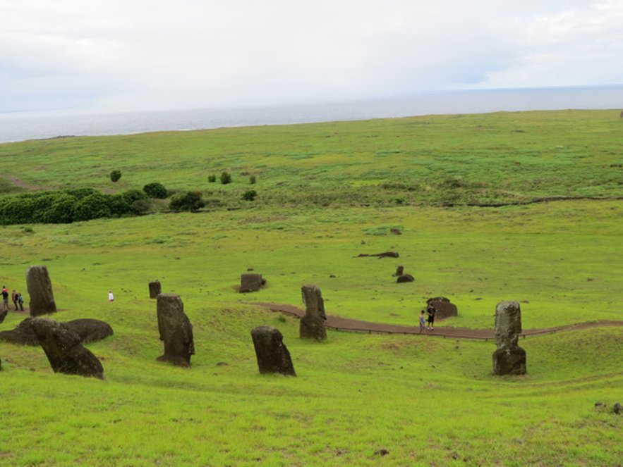
But my favourite site is the quarry. When I first heard the name, I pictured a rock excavation site where rocks were dug up. However, when you approach the quarry, it is as if the stone people have come to life and are walking out of the mountain from where they were born. A gently sloping green side of a volcano is scattered with upright figures. They seem to be walking down, stumbling and standing all over the slopes. The sight gave me goosebumps and a lump in my throat.

The moai were carved here from gigantic blocks of basalt and lava. Weighing many tons and measuring up to ten metres in height, their individual features were carved. I had heard that most figures only show the upper body while the lower half is still buried.

Before I saw them, I thought that this meant that the moai had been covered by drifting sand over the ages. But that is not true at all. There is no sand. Only lava and rocks. The artists did not have ladders, so they dug deep pits in which they lowered or raised the moai until they could reach their faces to carve them.

Once a figure was finished, it was erected and “walked” down the mountain to spots all over the island – a mind-boggling feat that National Geographic has tried to recreate.

Why did people stop carving and moving the figures? It seems like they were in the middle of ongoing projects when work came to a halt. No one knows why.

Why did the Rapa Nui create these statues in the first place? Scientists believe that well-to-do families ordered a moai in memory of an important member of the community. When this person died, male or female, a moai was constructed in his or her image and erected over their bones.

Once the grey basalt figure, with or without red lava topknot, had been given white coral eyes with a black obsidian center, it was believed that the deceased person’s spirit had entered the moai and would now protect Rapa Nui and its future generations.


For details on Easter Island and its history, click here: http://www.mysteriousplaces.com/easter_island/

See a reenactment of ‘walking’ the statues here: https://www.youtube.com/watch?v=yvvES47OdmY

All photos by Margriet and Kies Ruurs. For more of the Ruurs's travel adventures, visit their blog, Globetrotting Grandparents.

15 Sept 2017

Exploring the World Through Travel: Rapa Nui’s Moai

By Margriet Ruurs

I was lucky enough to take a trip to Easter Island, Chile, earlier this year. I had booked a flight from Santiago. Before getting there I imagined an old, small airplane. I don’t know why – but I had thought it would be a local airline with an old prop plane. The opposite turned out to be true: Latam is part of One World and operates a brand new Boeing 787 on the route to remote Easter Island across the south Pacific Ocean. Only during the long flight does it become clear how distant this place is. From mainland Chile you fly at a speed of 850 km an hour for about 5 hours! The island is almost halfway between mainland Chile and New Zealand.

Rapa Nui from the air.
We arrived in comfort. But now imagine that you are an early explorer, sailing the Pacific Ocean in search of new lands. After weeks of nothing but water, you spot land. A green island with round, cone-shaped hills and the odd ragged cliff dropping off into the roaring ocean. As this Dutch ship, under the command of Captain Roggeveen, cautiously approaches the island, furling the sails that billowed from its three tall masts, you spot people. Giants.

Huge, towering people standing shoulder to shoulder with their backs to the sea. These stone giants are most likely meant to honour chiefs and other important people. For more than a thousand years – no one knows their exact date – they have been standing here, silently. Only a few statues face out over the sea, looking in the direction of other Polynesian islands, possibly the Marquesa Islands from where the first inhabitants of Easter Island might have come by canoe.

Roggeveen did go on land and communicate with the native population. As it happened to be Easter for the European Christian sailors, they named the island Easter Island: Paas Eiland in Dutch, or Isla de Pascua in Spanish. Never mind that the island already had inhabitants and a name: Rapa Nui. Like other islands claimed by European nations, it has now gone back to using and being proud of its original name and so I shall refer to Easter Island as Rapa Nui here. Since 1965 the island has been under Chilean governance. It uses Chilean pesos but has its own Rapa Nui postage stamps.

The stone statues, for which the island is famous, are so shrouded in mystery that it is hard to realize that they stand on a normal island where regular people live in a regular town. I had only ever seen images of statues and green grass and found it slightly jarring to arrive in this mysterious place to see ordinary trucks, cola machines, dogs – just like in any other town. Where was the mystery?

We walked across the tarmac to the palm-frond-covered entrance of a tiny airport. Each and every new arrival is greeted with a lei of fresh flowers.  People here still speak Spanish but also Rapa Nui, which is very Polynesian and looks like Hawaiian to us.

Rapa Nui is roughly the same size as Canada’s Salt Spring Island with almost the same number of people, around 7000 – increasing with tourists. They also face similar problems, such as sustainability, water shortages and recycling. Of course this island is much further away from a mainland. Supplies used to come, and still may, once a year by ship. Everything else is flown in. So the cost of a soft drink or anything else is sky high. A small bottle of water, which was 1 dollar in Santiago, costs 3 dollars here. Everything needs to be recycled or re-used. A sign in our bathroom asked us not to "throw paper at the toilet" – which we took to mean no flushing of paper.


Our very first moai, or stone statues, was a row of five that, unlike all other moai, face out over the ocean rather than inland with their backs to the sea. Why? We can only guess and only “the ancestors” know the real answer. They sit near two platforms on which the moai typically rest. These platforms are built of huge square basalt blocks with straight lines and rounded corners. It is impressive how precisely these were constructed so many hundreds of years ago, without the use of metal tools.

Once the guide pointed it out, we noticed moai that have fallen forward, on their faces, and cracked. Many were destroyed during a civil war between the Long Ears and the Short Ears tribes around 1680, as well as by missionaries, neglect and the passing of time.

Top Knot lava stone
The standing, reconstructed moai are about 5 metres tall. Each face is quite individual. A few wear "top knots" – these round blocks of red lava have a smaller red part on top and are said to resemble not hats but hair, worn traditionally in a long ponytail tied in a knot on top of the head, just like most men here still wear it.
Typical modern men's "top knot" hair style on Rapa Nui
All photos by Margriet Ruurs. You can find more of Margriet's travel stories at Globetrotting Grandparents.


20 Jan 2017

"Effect of Activities on Bones" -- an excerpt from The Paleolithic Revolution

Stories from the Stone Age fascinate many people. Who were the long-ago humans who made cave paintings and carved ivory? I've often wondered how they turned rocks like flint or obsidian into knives and tools. The things that scientists learn from a scrap of bone, or an old carving, are amazing!

This year I got to put to use all my favourite archaeology facts while writing a book for Rosen Publishing, called The Paleolithic Revolution. It's part of a series called The First Humans and Early Civilizations.

Here's an excerpt from the first chapter, with the heading "Effect of Activities on Bones."

Bones are a lasting record of our lives. During the Paleolithic Revolution, modern humans were strong people. Their bones had much larger muscle attachments than is common today, even for professional athletes.

Their bones were harder, too. Bones from people born today are on average 15 percent weaker than bones from people born during the Upper Paleolithic Era. This is due to two factors. People today are less physically active and use more kinds of tools. Physical strength is less important for survival. People then spent a lot of time walking, gathering food, and hunting. Leading active lives and using simple tools made their muscles and bones strong, just as it does for athletes and construction workers today.

Paleolithic humans used their bodies as tools, putting stress and strain on their bones and joints. As people aged, their joints and backs wore out and became damaged. Bones broke from falls or fights, causing injuries like a rodeo rider would have today. Some breaks healed well, showing signs of good care. People broke their toes because their shoes were simple wraps or soft like moccasins, not rigid-sole boots. Their feet and toes were shaped from wearing sandals or soft skin shoes, instead of splaying wide from going barefoot all the time.

Paleolithic people’s lives affected their teeth, too. From chewing tough food, their jaws grew a little bigger than people today who eat softer food. Bigger jaws meant fewer impacted wisdom teeth than today. Their teeth had fewer cavities than today, too, because they ate fewer grains and other food that sticks to the teeth. But they had other tooth problems instead. Since people used their teeth as pliers and clamps, their teeth got worn down, chipped, and even cracked. People also chewed leather to make it soft. Some old people had teeth worn down to nubs.

22 Oct 2016

Iceman CSI: Tales from a 5300-year-old man

Forensic reconstruction imagines this is
what the 5300-year-old Ötzi looked like.
(Thilo Parg, CC BY-SA 3.0)
by Adrienne Montgomerie

An arrow sang through the air and plunged deep into a man’s shoulder 5300 years ago in Italy. That man fell as he gasped his last breath, his left arm flung awkwardly across his chest, pinned beneath him.

A mummy is not what you expect to find when you’re strolling through the Alp mountains with your husband. But that’s what happened to the group of mountaineers who found this mummified man in 1991.

What happened to this man? Why did he lay there, undiscovered, for so long? What can his body tell us about humans and life so long ago?

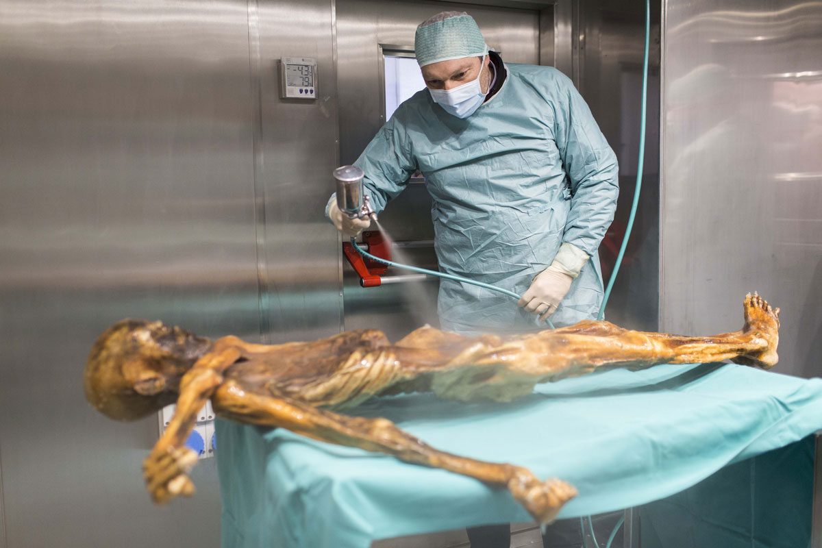
Because he died in a place that is always cold, his body did not disappear into the earth or get eaten by animals. All his parts are there, exactly where they were. He is not covered in rags like a mummy in a movie, but we say his body was mummified because it did not rot. This ancient man they named Ötzi, contains a lot of clues.
.

Learning without destroying

Early scientists would cut apart specimens to learn about them, but that destroyed the body. Today, scientists know that the more they can preserve, the more will be available for other scientists to learn from, and for new technologies that get developed in the future.

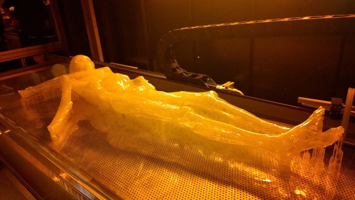
The body is too fragile let everyone examine it closely, so 3D printing was used to create a copy so people can get a closer look at him.
The 3D print formed the base that the sculpture is made from. (Materialise)
Preserving the iceman Ã–tzi, so that others can study him, means keeping his body in a room that is –6 °C and nearly 100% humidity — just like on a glacier. The room is dim too, to protect the artifacts from damaging light. An alarm goes off it the room changes.
Ötzi is kept at –6 °C and nearly 100% humidity. (South Tyrol Museum of Archaeology)
Dinosaur bones are replicated for display, too. That’s right, the bones you see in the museum are not the actual bones that were dug up. The originals are stored in conditions that keep them from falling apart, so that scientists (like archeologists) can study them.
.

What can scientists find out from the iceman?

Well, first, they can find out how long humans might have lived, so long ago. Because we have a lot of data about how bones age, scientists can estimate that Ötzi was 45 years old when he was killed.
Because of what we know about how vocal chords work, scientists can guess what Ötzi’s voice sounded like.

Because of the contents of his stomach, they can find out what kind of diet people had that long ago. His last meal was ibex, deer, and grain. His stomach also gives clues about where he travelled, because of the h. pylori bacteria they found in his gut came from Asia, very far away from Italy.

By analysing his DNA, they can find out that he was lactose intolerant, was likely to get heart disease, and had Lyme disease.
His shoes look a bit like Uggs.
(Wolfgang Sauber, CC BY-SA 3.0)

Because of the bits of clothes that were still on him, researchers can make guesses about the style of clothes he wore and the animals that they were able to kill (to use to make clothes).

Because of X-ray and CAT scans, we know there is an arrow-head lodged in his shoulder. But forensics showed he had many more injuries — the kinds that people get from a fight — and blood from four other people on his clothes and tools. Now experts think he actually died from a hit to his head.
.

Mysteries still

There’s still a lot you can’t know by examining a body. Wouldn’t you like to know where Ötzi lived and why he was in the mountains? Who he was fighting and why? How big was his family, and did his brothers and sisters play pranks on each other?
.

Learn more

There are a couple documentaries about Ötzi (Iceman Reborn, and others by NOVA), and several websites explaining different aspects scientists have discovered about him (follow the links in this article). You can even find out how a body becomes a mummy naturally. 

You can see the Ötzi copies in person at the DNA Learning Centres in New York city and Cold Spring Harbor, USA. To see him in person, you have to look through a small window into a climate-controlled room at the South Tyrol Museum of Archaeology in Bolzano, Italy.

14 Mar 2014

“Potbelly Hill” gives birth to new theories of civilization

By Judy Wearing

Tall, flat stones arranged in circles stand straight, their limestone edges sharply sculpted. Some are six metres in height, and decorated with a menagerie of carvings: lions, gazelles, foxes, donkeys, bulls, reptiles, insects, and birds. The pillars are enclosed inside circular walls. There are four such enclosures, back to back, each surrounding up to eight pillars each. Sixteen more enclosures remain out of sight, under the earth. These 'rooms,' with their rings of standing stones, were buried at Gobekli Tepe (potbelly hill), a man-made mound 15 metres high, located in Southern Turkey. These awesome monuments were made without metal. They were sculpted with stone tools, and transported hundreds of feet from a quarry without beasts of burden or wheels. At the time they were built, writing had not yet been invented. Neither had pottery. Their discovery has changed the way archaeologists think about human civilization.

Gobekli Tepe rivals Stonehenge in its complexity, but predates it by some six thousand years, hailing to 9600 - 8800 BC. It is older than the pyramids and the ancient cities of Ur and CatalhÓ§yuk. It is the oldest known building project on Earth. But it is not its age per se, its engineering, or even its artistry that make Gobekli Tepe so special. It is that the people who created and used it were nomadic hunter-gatherers living before the invention of agriculture. There is no local source of water, no traces of housing, cemeteries, domesticated animals or plants. The people who built this 'temple' did not live here, nor anywhere else permanently.


The existence of Gobekli Tepe turns the common understanding of the development of human civilization on its head. The old way of thinking has humans in Mesopotamia discovering that wild grains can be saved and planted, and wild animals captured and contained. This ‘Neolithic revolution’ encouraged people to settle in one place, growing and keeping food instead of hunting and gathering it. Then, as a consequence of the new stability, came increased food supply, growth of community, cooperation, division of labour, extra time to devote to art and architecture, religion, organized cemeteries, public buildings, etc. Gobekli Tepe, however, was built by a number of people over a significant amount of time, organized, cooperating, and practicing a common  religion -- all without the existence of stable, permanent settlements.

Besides demonstrating that long-held beliefs can be wrong, and that early human societies were more complex than previously thought, Gobekli Tepe is a spectacular site in its own right. What people were doing here is still a mystery, and the lack of writing means there is no voice from the past to tell us what these structures meant to their culture. There are some intriguing clues, however. For one, some of the T-shaped stones have belts and arms carved on them, suggesting they are stylized representations of people. For another, what look like benches are built into the walls – for visitors to rest awhile, dead or alive, in the company of the stone statues.

Some believe that Gobekli Tepe’s stone circles were sanctuaries to link the world of the living with the world of the dead. Today, they still function as a link to the world of the dead, the only connection we have to the culture that lived and died in that part of Turkey more than 11,000 years ago. The stones still tell stories of their builders, whispering secrets of our distant relatives.

7 Mar 2014

Tales in time: Criccieth Castle

By Marie Powell (Photos by L. L. Melton)

I love castle hopping, and Wales is one of the best places to explore ruins from bygone days. With some 400 castles in about 20,000 square kilometres (8,000 square miles), there's a lot to explore.

Last year I had the chance to see Criccieth Castle, located at the top of a rocky hill overlooking Cardigan Bay, North Wales. According to the Cadw's Criccieth Castle guidebook, the earliest records of the castle date from the 1230s, when Llywelyn ab Iorwerth (Llywelyn the Great) made it a main seat of power in North Wales.

He built the inner ward of the castle, including the twin towers, using a mix of angular stones from the rock around the castle, glacial boulders, with grey mortar made from beach gravel. The D-shaped towers are typical of Welsh native castles, but these twin gatehouses may have also been influenced by castles of the Marcher lords at Cheshire and Montgomery.

The various princes and kings who owned and controlled Criccieth had a hand in adding to its architecture. Although determining the date of a castle ruin might seem straightforward, there is a controversy over who built what part of Criccieth. Experts turn to structural evidence in the ruins to develop their theories and time estimates.

For example, Llywelyn ap Gruffudd (Llywelyn the Last) added an outer ward to the castle. The mortar used in his time is more gravelly, with stones and boulders brought to the site (rather than quarried from the castle rock) along with blue-grey slate. Experts believe the square holes about eight feet from the top mark the height of the towers during the time of the Welsh princes.

Arrow slits that can be seen at the ground level of the towers, as well as at strategic positions throughout the castle, offered a protected spot for archers guarding the castle from attack. Criccieth had several other buildings and towers as well, including one thought to have housed a trebuchet (a machine to throw stones) or a catapult for warding off enemy attacks.

Criccieth fell to Kind Edward I of England in March 1283, and was later held by Edward II (1307-1327) as well. They built up the top of the towers to the height we see today. The square holes held horizontal beams for a fighting platform (or "hourd") projecting from the wall. The English also used castle rock again, but the mortar from this period contains more shells.

Edward II spent over £250 on repairs and refurbishing, according to the guidebook. The castle was finally destroyed in about 1404, during the time of Owain Glyndwr, and was never rebuilt.

A small museum and gift shop at Criccieth tells more of the history and architecture of the castle, with colourful floor plans such as this one.

Another useful resource is the Castles of Wales website, which includes a discussion of the history, geography, architecture, and archaeology of this and other Welsh castles. As well as the guidebook, Welsh Castles by Adrian Pettifer also offers discussion of Criccieth and other castles by area.

Marie Powell is the author of seven books for children, including Dragonflies are Amazing (Scholastic Canada) and a six-book Word Families series (Amicus Publishing). Her second six-book series is expected this fall.


13 Sept 2013

Great White (Northern) Science – LINKS and a CHALLENGE

By Claire Eamer

There’s lots of great science happening in the Great White North. (Actually, it’s not very white today – gorgeous fall colours instead – but you know what I mean.) And a lot of that science is being done by Northerners themselves. So I decided to spread the word.

Here’s the LINKS bit: I’ve dug out a few kid/teacher/librarian-friendly links for you. You’ll find them below, with short notes about where they lead.

And here’s the CHALLENGE bit: Hey, all you Northerners, scientists, science freaks (that’s me!), geeks (young and old), and wizards of Google-fu - let’s find some more! If you have a favourite science link to something that’s taking place in northern Canada, post it in the Comments section at the bottom. We can build something here.

So, here’s my first kick at the can - a mostly-but-not-entirely Yukon contribution.

This scimitar cat once roamed the Yukon grasslands. Today,
it snarls at visitors to the Yukon Beringia Interpretive Centre
in Whitehorse. Claire Eamer photo
Would you like to learn about the amazing animals that roamed the Yukon 20,000 years ago, when most of Canada was buried under kilometres of ice? Check out the Yukon Beringia Interpretive Centre's Education Corner. There's everything from educational materials for senior grades to colouring sheets for the little kids. And check back regularly. I was talking to the Beringia Centre folk yesterday, and they're planning some great new additions to the site.

If I've got you hooked on mammoths, giant sloths, and scimitar cats, there's more information about the latest research (and lots of cool photos) in the online (pdf) booklets Ice Age Klondike and Ice Age Old Crow, published by the Yukon Government.

By the way, if you want to know what life is like today at Old Crow, the Yukon's most northerly community and home of the Vuntut Gwitchin First Nation, check out the community website. It offers a sampler of the Gwich'in language, traditional stories, culture, history, cooking (lots of caribou recipes!), and a whole lot of other entertaining bits and pieces of information, including a collection of videos made by Old Crow students.

Back to ice ages and climate: how about climate change? The climate is warming faster in the North than anywhere else in Canada. What do northerners think about that? In 2000, the Inuvialuit people of Banks Island talked about their lives and how climate change is affecting them in a video called Inuit Observations of Climate Change, which is online in both a short version and a long version.

All that warming has turned up a few surprises. High in the  mountains of the Yukon and the Northwest Territories, there are patches of permanent ice, too small to be glaciers but too big to melt over the short summer. Until recently. Now many of them are melting and revealing a record of plant, animal, and human life going back thousands of years. I blogged about the ice patch discoveries here last year. The online (pdf) booklet The Frozen Past has both information and photos of Yukon finds. And Archaeology magazine has an online article about ice patch finds in other parts of the world.

For first-hand accounts at what it's like to live and do research at the northwest edge of Canada, check out this series of podcasts produced by the Wildlife Management Advisory Council (North Slope). You'll find everything from elder Danny C. Gordon's account of a lifetime of travel across the Yukon North Slope and park ranger Richard Gordon's song in praise of Herschel Island to permafrost researcher Chris Burn's musings on using both scientific and traditional knowledge to understand the land and its future.

Okay, that's my contribution - for now. I won't promise not to come back and add more links in the Comments section, but I'll let you guys have a chance first. What's your favourite science link for the North? And don't think just about the northern territories. Besides the Yukon, the Northwest Territories, and Nunavut, there's Labrador, Nunavik, and the northern regions of most of the provinces. Have I left anyone out? If so, add it in below.